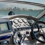
Marine Navigation GPS
 If you are going to be out on a body of water, whether, a lake or a bay or open sea, it would help to have a marine navigation GPS device. Marine navigation GPS systems are global positioning systems (GPS) which are specifically designed for marine use. They have additional features when compared to other types of GPS such as the ones which are used in cars or while hiking. These additional features help you with your navigate while on water and also help you remain safe while at sea.
Coastal Maps. Most Marine GPS systems will contain a base navigation map which help you navigate. Maps of different coastal areas are available. You could download them into your Marine GPS device and use them. If you travel to many different coasts, you can download the map for the relevant area when you are going there. Replace it once the use is over. Some have SD card slots which allow you to add coastal maps without a computer.
Chartplotter Or Charting Aid. Almost all marine navigation GPS systems have features which help you chart your course. The device allows you to save information about locations. Once you have saved the information you can just select the location you want to go to and the device will chart a course to the place for you allowing you reach the place effortlessly.
Networking. You can use the networking feature on many modern marine navigation GPS systems to link to a network and get additional info. Since this is real time data it will be very helpful in knowing your sea.
Current, And Tide Info. If your marine GPS has the networking feature you can use it to get current and tide info. Lack of information about currents is dangerous. Current and tide information can keep you safe while at sea.
Sonar and Radar Information. Sonar and radar can help you find obstructions on your path allowing you to stay clear of such areas (remember Titanic) thus keeping you safe from getting stuck or sinking.
Depth Information. Depth information is very important, not just for fishing but also to prevent your ship or boat from getting grounded. Most marine navigation GPS systems have the facility to find depth contours. Many of the devices have depth information about the US coastal and offshore areas as well as information about thousands of different US lakes. They will also give you topography information. If you want information on other coasts, shores and lakes, you could download them.
Fishfinder. A fishfinder will allow you to track movement of fish. Charting a fish shoal’s progress can help you find the fish shoal at other times, predict areas where the fish shoal could be found, thus aiding in fishing.
Navigable Channels. These are channels which are easy to navigate. This information will keep you on a safe course while at sea.
Fish Hotspots. These will give you information about hundreds of fishing hotspots in a number of lakes. The information pertains to specific marine GPS brands and models though. Not all devices may have it.
Other Relevant Information. You could get info on port plans, marine aids etc on some marine GPS units. Some have radio and weather options as well.
Going out on a lake is risky business. Open sea even more so. There are possibilities of storms, getting caught in currents, getting hit by obstacles. You can go off course and could get lost. There is much more of a chance of getting lost and losing your life at sea than on land. This probably is the reason why Marine Navigation GPS systems have so many advanced functionality compared to land GPS. Still, Mother Nature is strong and it pays to be careful and respectful of natural forces even if you have a marine navigation GPS. Also, it is better to learn navigating with non electric devices like chart and compass, since electronic devices could sometimes stop functioning and then you will really be at sea.
